Posted on October 28, 2025
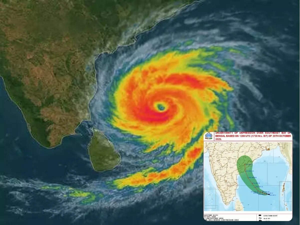
A powerful weather system over the Bay of Bengal has strengthened into Cyclone Montha, and the India Meteorological Department (IMD) warns that it is likely to make landfall along the coast of Andhra Pradesh by the evening or night of October 28, 2025. As of early Tuesday morning, the storm was centred about 190 km south-southeast of Machilipatnam and 270 km south-southeast of Kakinada, moving north-northwestwards at a speed of approximately 15 km/h.
The IMD has forecast that landfall will occur between Machilipatnam and Kalingapatnam near Kakinada, with sustained wind speeds of 90-100 km/h and gusts up to about 110 km/h. A “severe cyclonic storm” category has been declared for Montha, underscoring the serious nature of the threat.
Precautions, Alerts & Impact
Warnings & Evacuations
- Authorities have issued red alerts for coastal Andhra Pradesh, Odisha and Tamil Nadu; yellow alerts have been raised in states such as Karnataka, Maharashtra, Kerala, West Bengal and Gujarat.
- In Andhra Pradesh alone, approx. 3,778 villages across 338 mandals are expected to be impacted by heavy rainfall as a result of Cyclone Montha, according to Chief Minister N. Chandrababu Naidu.
- Evacuation efforts are already underway: thousands of residents from vulnerable coastal areas have been moved to relief camps in anticipation of the landfall.
Disruptions and Preparations
- Over 32 trains passing through Visakhapatnam and surrounding areas have been cancelled or diverted as a safety measure.
- In Tamil Nadu, parts of Chennai and Tiruvallur district have seen heavy rainfall; schools have been shut in advance of the worsening weather.
- The sea conditions are already rough along Odisha’s coast. Fishing boats have been instructed to stay in harbour (Gopalpur port, Ganjam district) and avoid venturing out.
- Disaster response teams are fully activated: Numerous teams of the National Disaster Response Force (NDRF) and the State Disaster Response Force (SDRF) are in position along coastal zones, along with life-boats, ambulances, and standby medical camps.
What to Expect
Residents and travellers in the affected regions should prepare for:
- Sustained high winds up to 100 km/h (gusts ~110 km/h)
- Very heavy rainfall, especially in coastal districts
- Possible storm surge and rough seas along the coast, leading to flooding and potential coastal erosion
- Disruption to transport (rail, road, sea) and power outages
What You Should Do
- If you live in a coastal or low-lying area of Andhra Pradesh, Odisha or Tamil Nadu, follow evacuation instructions and move to designated shelters if advised.
- Stay away from the sea and avoid going out during storm-force winds or heavy rainfall.
- Secure outdoor furniture, shop fronts, and items that could become hazards during high winds.
- Keep an emergency kit ready: torch, batteries, first-aid, drinking water, essential medicines.
- Maintain updates from local authorities, the IMD and trusted news sources rather than rumours.
- For travellers: Check train and flight cancellations/changes, avoid non-essential movement in affected regions.